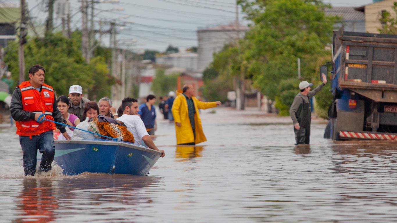
Very heavy rains until Friday in Santa Catarina and Rio Grande do Sul are expected to cause flooding, flooding, landslides, collapse of barriers, flooding of rivers and flooding in both states | CAMILA DOMINGUES/PALÁCIO PIRATINI/ARCHIVES
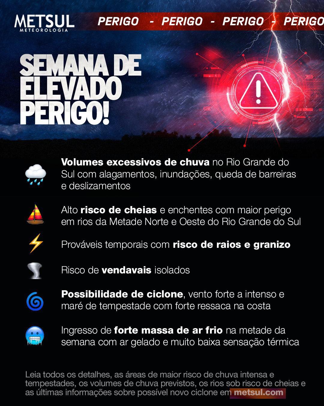
MetSul Meteorologia warns of high risk of flooding in rivers and flooding in Rio Grande do Sul and Santa Catarina in the coming days. Rainfall volumes will be sufficient to cause the level of several rivers to rise sharply and some to burst their banks, causing floods and floods.
It is raining almost every day this week in southern Brazil, although in some areas in fewer days, such as southern Rio Grande do Sul, which will experience instability between Wednesday and Friday. In the northern half of Rio Grande do Sul and in Santa Catarina, the instability will be more persistent with rain forecast every day until Friday, before the weather improves next weekend.
This long sequence of rainy days between the northern half of Rio Grande do Sul and the state of Santa Catarina will first be the result of a warm front that will become semi-stationary and then the formation of a potentially intense extratropical cyclone between the two states in the middle of the week. The cyclone will further enhance instability and bring larger and locally excessive rainfall volumes.
According to projections from numerical models analyzed by MetSul, a very large area between the northern half of Rio Grande do Sul and Santa Catarina is expected to have precipitation volumes close to or above the historical average precipitation for the entire month of July this week. In some places, it cannot be excluded that the rain reaches twice the average monthly precipitation in a few days.
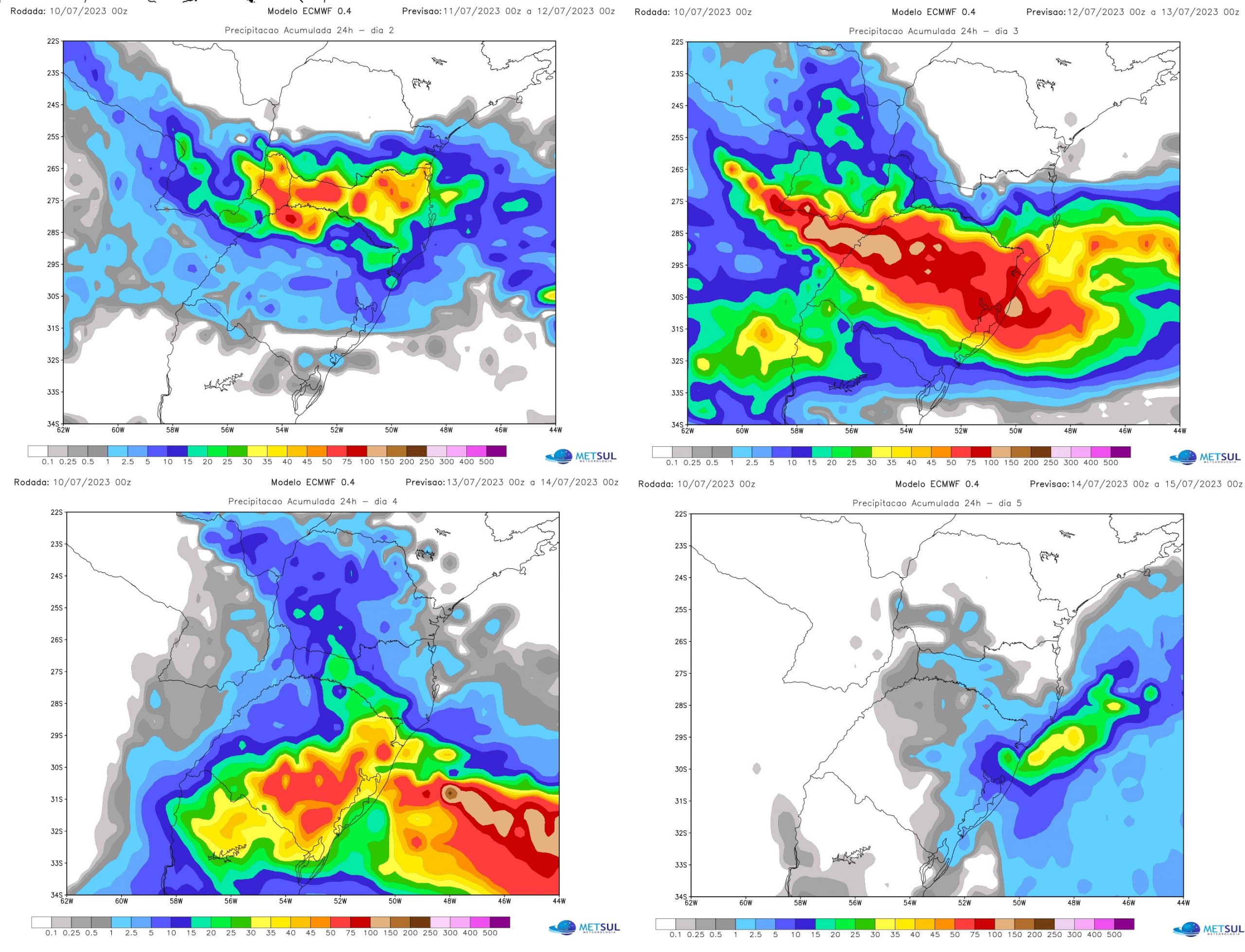
The most critical rainy period is expected between tomorrow and Thursday in the south of the country. This Tuesday, the rain should be more abundant on Santa Catarina. On Wednesday, the most intense rainfall will occur over Rio Grande do Sul and part of Santa Catarina as a cyclone begins to form on the mainland between the two states.
On Thursday, in turn, the rain will again be more abundant in the state of Rio Grande do Sul with the cyclone near the coast and on Friday it will begin to decrease as the cyclone moves away from the coasts of southern Brazil. . This is shown in the maps below with the 24-hour rainfall projections for the European pattern between Tuesday and Friday.
Although it has already rained, the most critical period of rain in Porto Alegre and the metropolitan area will be between Wednesday and Thursday. During these two additional days, rainfall in Greater Porto Alegre could be near or above 100 mm With a cyclone in preparation over Rio Grande do Sul, showers are likely to be torrential at times and capable of generating volumes high in a short interval, increasing the risk of flooding, especially in the fourth and first half of the fifth.
Projections of rainfall volume
Rain this week already started yesterday in Santa Catarina and Paraná, in towns further west, including isolated medium to large hail west of Santa Catarina. This Monday, the rain persists between the two states and reaches points in the northern half of Rio Grande do Sul.
However, the heaviest rainfall volumes are forecast for the 72 hours between this Tuesday and Thursday in southern Brazil, as the heavy rainfall scenario tends to worsen due to cyclogenesis (formation of a cyclone) with very strong accumulations over a short period. in several cities.
The numerical models analyzed by MetSul all, without exception, indicate heavy rains between Rio Grande do Sul and Santa Catarina. Differences occur regarding which locations may have the highest volumes, but the risk of precipitation, according to MetSul’s assessment, is particularly high for west and west-central Santa Catarina, south Santa Catarina and the northern half of the Rio Great South.
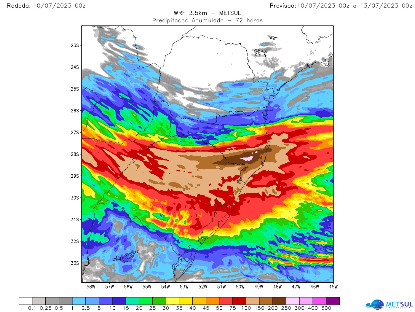
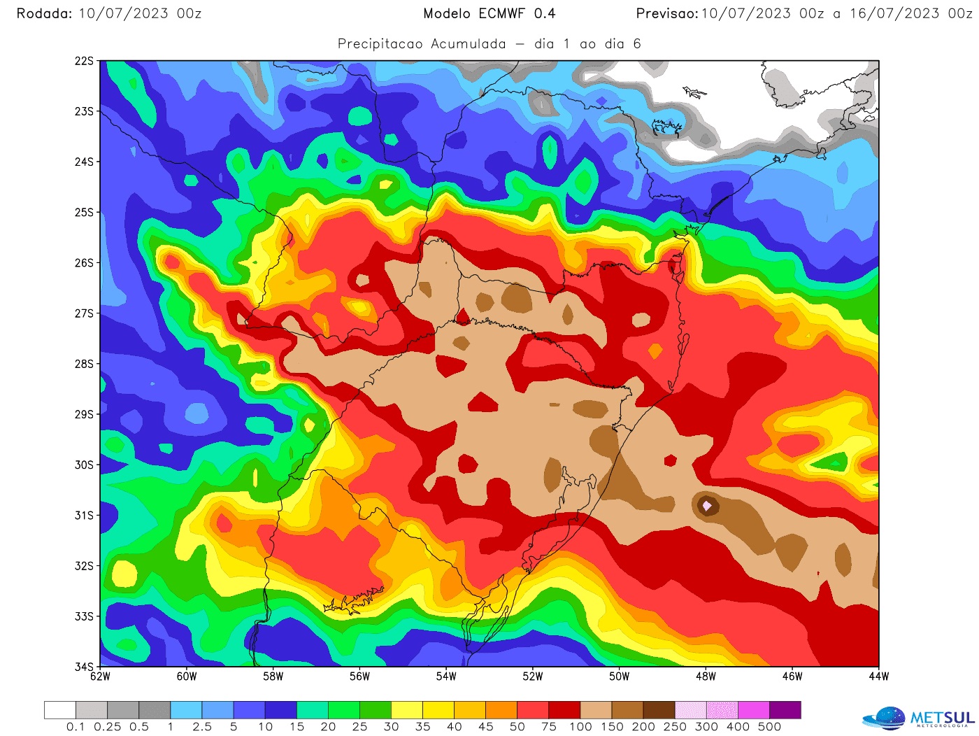
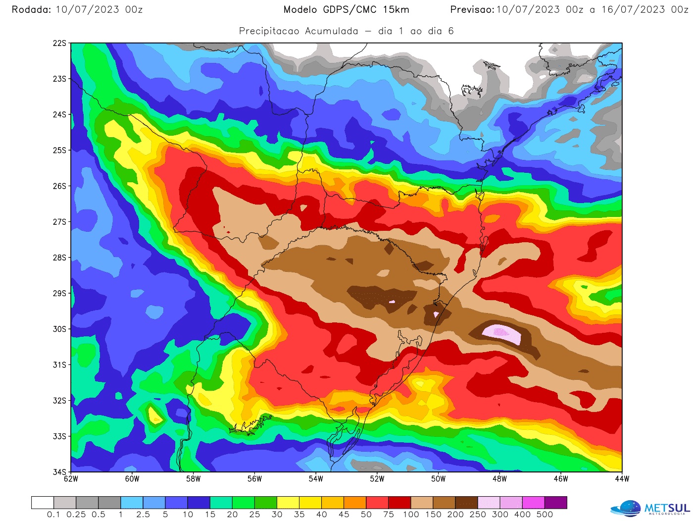
According to the models, a large area between the two states should have rainfall between 100 mm and 200 mm in many cities with the possibility of marks greater than 200 mm or 250 mm at certain points. Watch the 72-hour rain projection from our high-resolution WRF model only up to 9 p.m. on Wednesday, with data starting at 9 p.m. on Sunday, therefore not capturing rain for the final hours of Wednesday, Thursday and Friday. Note that in just these 72 hours, the model already projects volumes greater than 100 mm in many municipalities and greater than 200 mm in some.
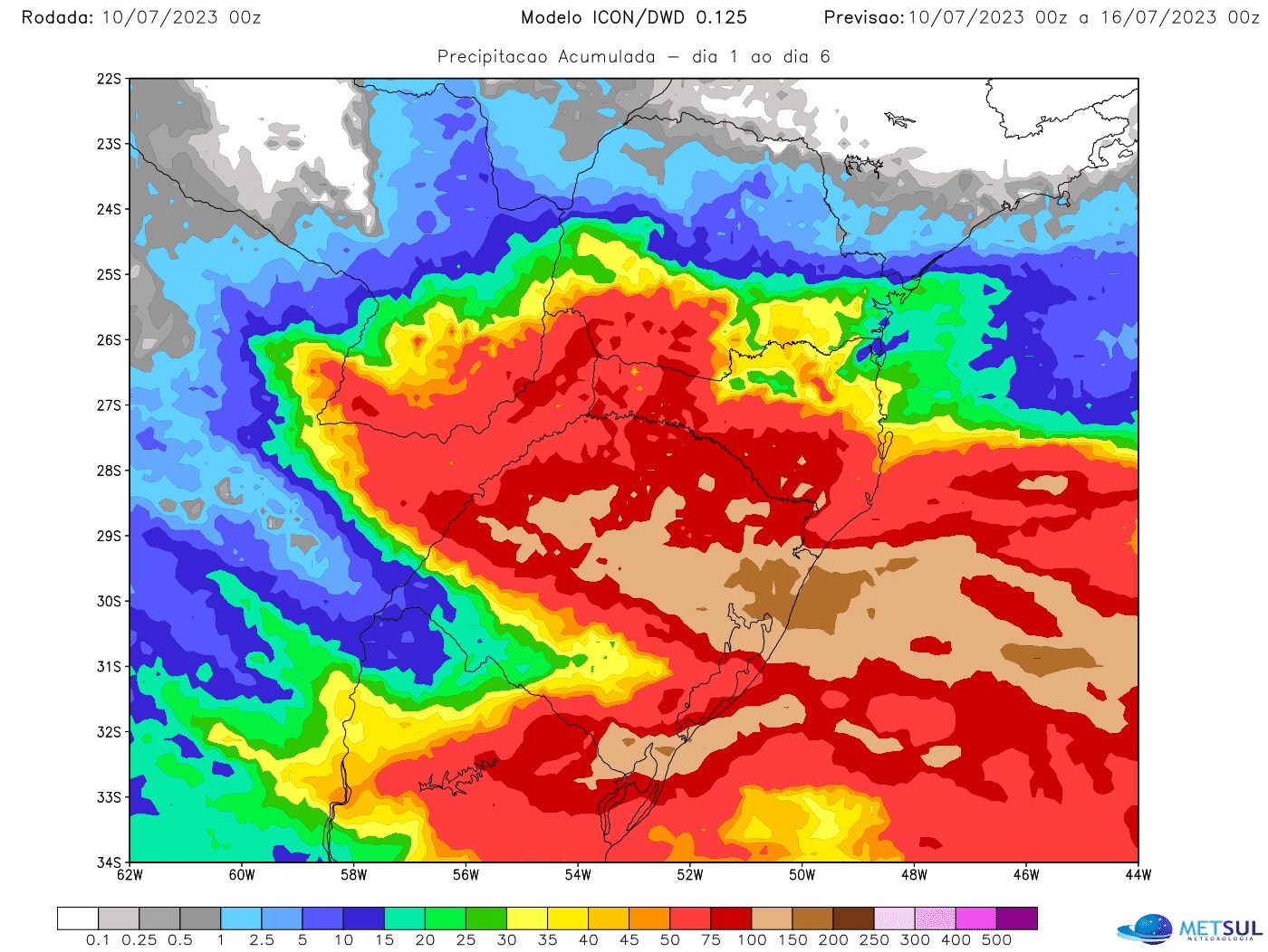
The following maps illustrate the forecast rainfall scenario for the period of greatest instability with data from so-called global models. These are the cumulative precipitation projections for this week, starting at 9 p.m. Sunday, for the German Icon models, the European model (ECMWF) and the Canadian model.
Much of these volumes are expected to come between Wednesday and Thursday, which will be the most critical period of instability, especially in Rio Grande do Sul. The extratropical cyclone must create conditions for torrential downpours capable of generating very dangerous flash floods.
Impacts of excessive rainfall and risks
The very high rainfall volumes forecast for the week will be likely to cause flooding, flash flooding, landslides and the collapse of highway barriers, among other consequences. Among them, full of rivers and consequent floods in some cities.
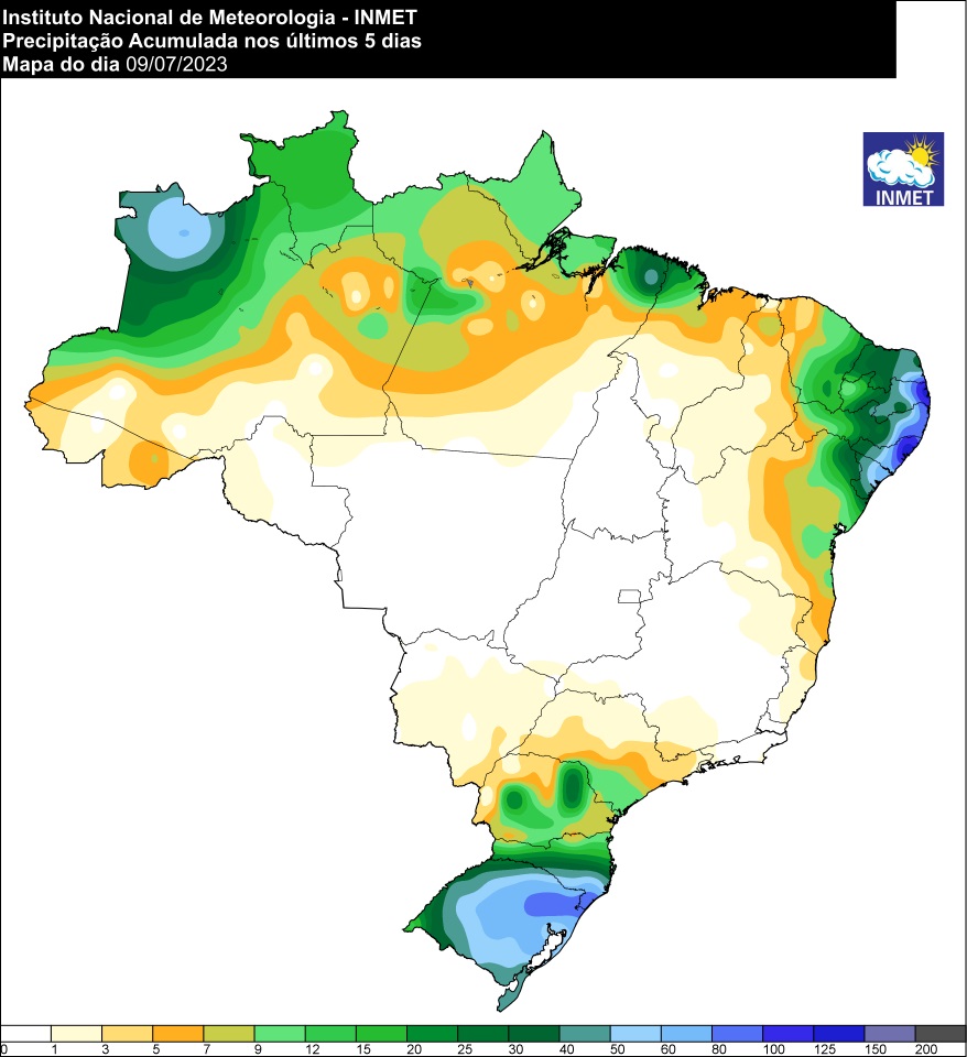
MetSul finds that there is an aggravating factor in the hydrological situation. Heavy rain will fall on areas that just received heavy rain between Friday (8) and Saturday (9), when it rained 80mm in Greater Porto Alegre and points northwest of Rio Grande do Sul, and up to 100 mm to 130 mm on the north coast, in the valleys and part of the Alto Jacuí. In the extreme south of Santa Catarina, it rained between 100 mm and 150 mm with a maximum of 153 mm in Praia Grande.
That is, some cities may have the sum of the two rain events, the one from the end of last week and the one that is beginning, accumulated from 200 mm to 400 mm in a single week. With the rivers already heaved by what has rained and what is yet to rain, river flooding will be inevitable and there will be flooding.
The most excessive rain volumes in Rio Grande do Sul will be concentrated exactly in the regions that had the highest volumes at the end of last week and, worse, where the greatest number of rivers in the territory of the state of Rio Grande do Sul are located, in this case the northern half.
Thus, from now on it is necessary to be aware of the risk of flooding in rivers such as the Jacuí, the Sinos, the Caí and the Taquari, among others. Uruguay, which has its sources in the north of the state on the Pelotas River, is also expected to have a flood that will not be reflected in the western border until next week, as it will take days for the flow to cross the bowl. west of Rio Grande do Sul. The same can happen with the Guaíba, in Porto Alegre, where the flood usually occurs a few days after the rainy event with the arrival of the flow from the contributing rivers.

“Prone to fits of apathy. Beer evangelist. Incurable coffeeaholic. Internet expert.”

